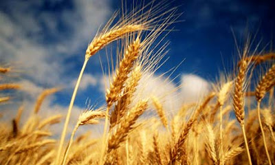
Symbols of North Dakota:
North Dakota was the 39th state in the USA; it became a state on
November 2, 1889.
State Abbreviation – ND
State Capital – Bismarck
Largest City – Fargo
Area - 70,704 square miles [North Dakota is the 19th biggest state in eathe USA]
Population - 642,200 (as
of 2000) [North Dakota is the 47th most populous state in the USA]
Name for Residents - North Dakotans
Major Industries - farming (wheat, barley, oats, flaxseed), cattle,
mining (lignite, soft coal), electrical power generation.
Major Rivers - James River, Missouri River, Red River
Major
Lakes - Lake Sakakawea, Lake Ohe
Highest
Point - White Butte - 3,506 feet (1,069 m) above sea level
Lowest
Point - Red River - 750 feet (230 m) above sea level
Number
of Counties – 53
Bordering
States - Minnesota, Montana, South Dakota
Origin
of the Name North Dakota - Dakota
was what the Sioux Indians called themselves.
State
Nickname - Peace Garden State, Flickertail State, Roughrider
State
State
Motto - " Liberty and union, now and forever, one and
inseparable"
State
Song - North Dakota Hymn
Flag
State Bird
Western Meadowlark
State Fish
Northern pike
State Honorary Equine
Nokota breed
Wild prairie rose
State tree
American elm
State fossil
Teredo Petrified Wood
State beverage
Milk
State dance
Square dance
History
Native
Americans and the Fur Traders
The first farmers in the region of whom there is definite knowledge were
Native Americans of the Mandan tribe.
Other agricultural tribes were the Arikara and the Hidatsa. Seminomadic and
nomadic tribes were the Cheyenne, Cree, Sioux, Assiniboin, Crow, and Ojibwa.
With the Louisiana
Purchase of 1803 the northwestern half of North Dakota became
part of the United States. Earlier the Lewis and
Clark expedition had wintered (1804–5) with the Mandan and the North West
Company and the Hudson's Bay
Company had established trading posts in the Red River valley.
These ventures introduced an industry that dominated the region for more than
half a century. Within that era the buffalo vanished from the plains and the
beaver from the rivers.
Early Settlers
and the Sioux
An attempt at agricultural colonization was made at Pembina in 1812 , but
the first permanent farming community was not established until 1851, when
another group settled at Pembina. This was still the only farm settlement in
the future state in 1851 when the Dakota Territory was organized. The territory
included lands that would eventually became North Dakota, South Dakota,
Montana, and Wyoming.
Present-day
North Dakota
The state's heavy dependence on wheat and petroleum has made it unusually
vulnerable to fluctuations in those markets; North Dakota has undergone a
number of booms and busts in its petroleum industry. Red River flooding in 1997
devastated Grand Forks, adding to economic problems. In recent years North
Dakota has become more urbanized, and telecommunications and high-tech
manufacturing have created jobs, but between 1990 and 2000 it had the slowest
rate of population growth of all the states.
More information:
Geography
Situated in the geographical center of North America, North Dakota is subject to the extremes of a continental climate. Semiarid conditions prevail in the western half of the state, but in the east an average annual rainfall of 22 in. (55 cm), much of it falling in the crop-growing spring and summer months, enables the rich soil to yield abundantly. North Dakota is one of the most rural states in the nation; the cities and towns supply the needs of neighboring farms, and industry is largely devoted to the processing of agricultural products.
The eastern half of the state is in the central lowlands, a belt of black earth covered in spring by the soft green of sprouting grain and later by the bronze of flowering wheat or the blue of flax. Along the banks of the Red River lies a wedge of land, c.40 mi (60 km) wide at the Canadian border and tapering to 10 mi (16 km) in the south, that is the floor of the former glacial Lake Agassiz. Treeless, except along the rivers, and without surface rocks, this flat land was transformed into the bonanza wheat fields of the 1870s and 80s, with farms ranging in size from 3,000 to 65,000 acres (1,200–26,000 hectares). Today the average farm in the Red River valley is about 450 acres (180 hectares); the state average is about 1,300 acres (525 hectares). Its major crop, wheat, is varied with such crops as flax and seed potatoes.
To the west of the valley a series of escarpments rises some 300 ft (91 m) to meet the drift prairies, where rolling hills, scattered lakes, and occasional moraines form a pleasant and fertile countryside. The productivity of the soil makes North Dakota a leader in wheat (ranking second in the nation), barley, sugar beets, oats, soybeans, and sunflowers. In income earned, however, cattle and cattle products exceed all the crops except wheat.
In the western part of the state a combination of unfavorable topography and scant rainfall precludes intensive cultivation except in the river valleys. An area some 50 mi (80 km) E of the Missouri River is a farm and grazing belt, separated from the drift prairies by the Missouri escarpment. Westward from the Missouri rolls an irregular plateau, covered with short prairie grasses and cut by deep gullies. Where wind and rain have eroded the hillsides there are unusual formations of sand and clay, glowing in yellows, reds, browns, and grays. Along the Little Missouri this section is called the Badlands, so named because the region (once described as "hell with the fires out") was difficult to traverse in early days. Situated there, where from 1883 to 1886 the young Theodore Roosevelt spent part of each year ranching, are the three units of the Theodore Roosevelt National Park. Bismarck, on the eastern bank of the Missouri River, is the capital and Fargo is the largest city.
To learn more about the geography of North Dakota, visit this links:


Немає коментарів:
Дописати коментар